The number of tourists who visit the Big Sur coastline continues to increase annually, taking a toll on the natural resources people flock to the area to see.
- Photo By Camillia Lanham
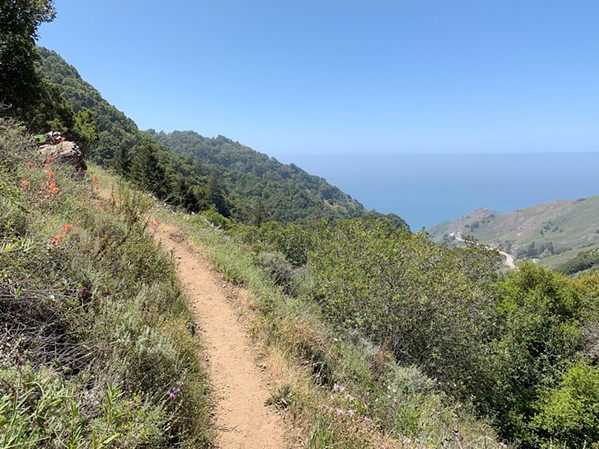
- BIG SUR PLAN The Los Padres National Forest Monterey Ranger District recently released a Visitor Use Management Plan to help the district manage the millions of visitors Big Sur gets annually every year, including addressing visitation issues along Highway 1 near the Salmon Creek Trail (pictured).
"It's in the millions, probably in the 4 million to 5 million range every year. So how do we manage that when we don't have the infrastructure to do it?" Los Padres National Forest Monterey Ranger District Ranger Fin Eifert said. "Three years ago, we started this effort, and the intention was to use it as a means to address an issue, but also build community."
The district released the results of that effort during the first week of June: The Coastal Zone Visitor Use Management Plan, which sets the foundation for tackling some of the issues that result from intense visitor use. It aims to strike a balance, Eifert said, between public use and resource protection.
"The area is experiencing unprecedented visitor use, resulting in traffic congestion, and expanding dispersed camping that is becoming concentrated on previously undisturbed areas," the plan states. "This is resulting in increased fire risk, human waste and litter issues, deteriorated road conditions, off-road vehicle use and associated resource impacts, and conflicts with local landowners."
While the plan doesn't lay down specific projects, it's meant to provide a framework that can help guide future short-, mid-, and long-term projects—all with the aim of getting areas along the coast to a "desired condition."
"What do people want the area to look like, and the experiences to be like in the future?" the plan states.
Eifert said the interagency collaboration also included several rounds of public meetings, virtual meetings, phone calls, and input from several groups along the 90 miles of coastline it manages alongside California State Parks and other private landowners. Together, they zeroed in on the desired condition of several places along the coast—such as San Carpoforo and Sand Dollar beaches, the Pine Ridge Trail to Sykes Camp, and dispersed camping along the South Coast—and outlines the gap between current conditions and desired conditions.
For instance, when it comes to dispersed camping: There's often more demand than the number of available campsites; the size of the groups is larger than it should be; the number of user-created campsites and spur roads are expanding into unsustainable locations and sometimes private property; there's litter, human waste, and illegal fires; and some visitors are unprepared for backcountry travel. The desired condition envisions an area that offers dispersed camping and sightseeing in an uncrowded setting with campsites, roads, and trails that are clean and free of human waste and trash.
"There is a feeling of 'getting away from it all' for those who are prepared and skilled in backcountry travel," the plan says. "User-created pathways and campsites are nonexistent."
What the district is doing now, Eifert said, is starting to identify the management practices Los Padres can engage in immediately that are low-risk and don't require a National Environmental Protection Act review.
This includes creating better communication between lodging sites along the coast. Rather than leaving visitors to fend for themselves when there isn't a hotel room or campsite available in once place, lodging sites can let them know what's available. Improving cellphone coverage and creating a website or application that holds a real-time campsite inventory of what's full and vacant that day could help alleviate some of the dispersed camping issues, Eifert said.
"Wouldn't it be great if you could go onto your phone anytime in Big Sur and find out, hey, there's a campsite right here?" he said. "But right now, that's impossible."
He added that visitor education (such as letting people know to pack it in, pack it out) is a huge component of the work ahead, as well as ensuring there's more of a ranger presence from Los Padres, something the district's already working on. He also envisions the potential of the Salmon Creek Station along Highway 1 to serve as a visitor and information center along the South Coast—something that would require an environmental review, among other things, because it's a historic building.
With the visitor use plan out, Eifert said Los Padres plans on holding public meetings on both the North and South ends of Big Sur, as well as a virtual meeting that everyone can attend on June 25. During those meetings, the district can answer questions, give an overview of the plan, and get input for the future.
"It's a solid foundation. It's not perfect. It's not a silver bullet that will solve all of the coastal issues, but it's a place to start," he said. "These are all big challenges, and they're not easy to solve. They're going to take some time." Δ
Comments